Corias - Core Interpretation Assistance - 74, Allee de la Robertsau F-67000 Strasbourg
Phone: +33.3.88.24.24.00 - Mobile: +33.6.07.56.11.78 -
Mail: christian@corias.com
© Corias 2018 - All rights reserved.
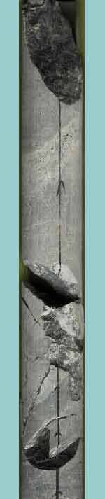
In the case of a non oriented coring, the geological planes and lines collected on the cores with the AS3D are oriented by reference to an arbitrary reference line, drawn on the cores after a carefully reconstitution of the core fragments to obtain a maximum connected length. The reference scribe line is drawn and recorded on each connected length of core.
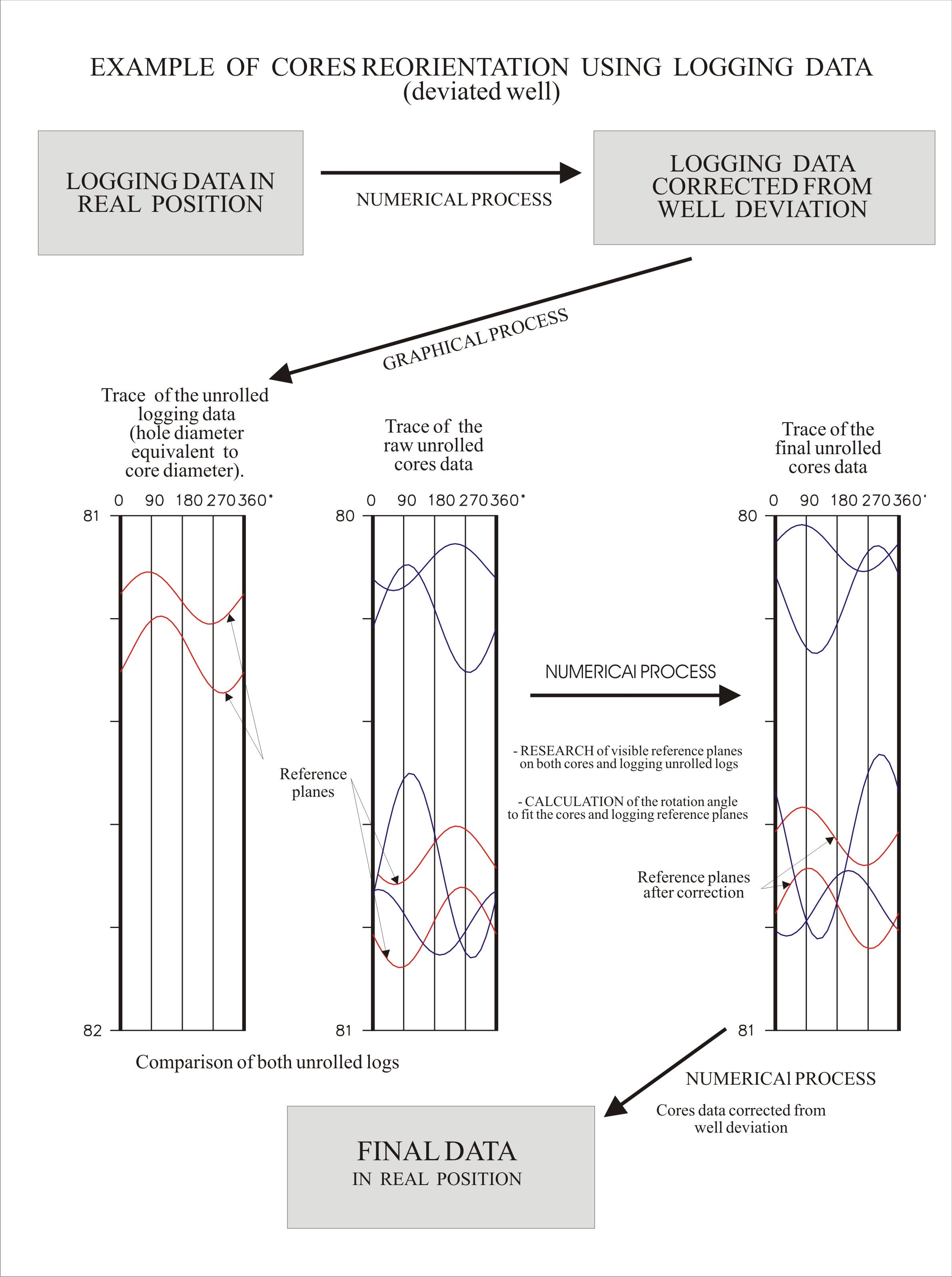
In the data processing, the “raw data” oriented referring to the scribe lines are being reoriented into the real geographic position as following.
The coupled software package of the AS3D system allows instantaneous plotting of diagrams such as stereonet plots and unrolled core logs.
These two types of diagrams are plotted for the raw data of each scribe line. On these diagrams, the orientation of each geological plane is focussed by a colour and shape code.
The same types of diagrams are plotted for the data provided by the borehole imagery and for the same interval of depth.
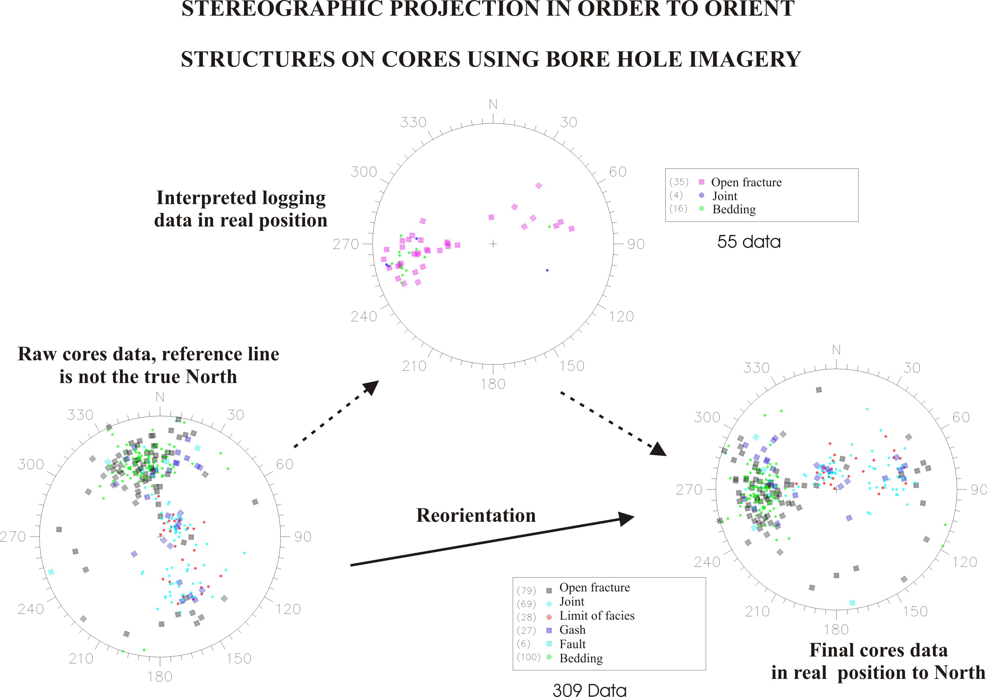
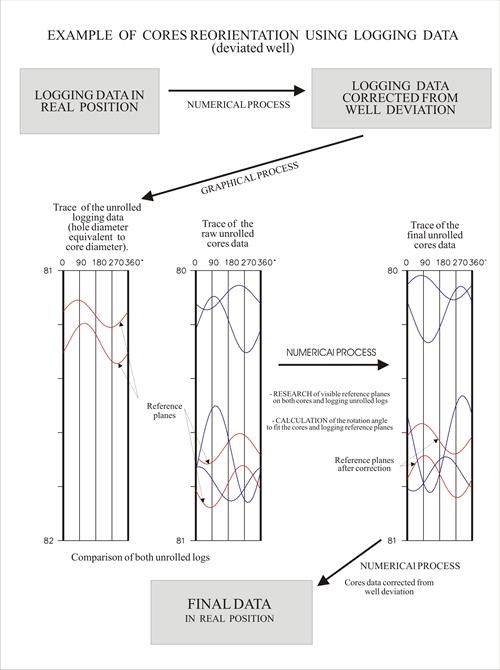
The geologic spatial organisation characterise generally by the individualisation of different families for planes such as fractures, cemented fissures, bedding planes, stratification joints, visible on both core and imagery plots like parallel traces on unrolled logs (figure 1) or same area on Stereonet plots (figure 2). Special attention is made to find good reference planes (i.e. similar feature at similar depth) that can be used to validate the comparison.
The angles between these reference families are calculated in order to compare two by two the diagrams for each non-connected scribe lines. Generally there is a good fit between the structure organisation on cores and imagery diagrams, (even if there are less planes in the imagery diagram) so it is easy to rotate all the raw data from the corresponding angle.
The high precision of the AS3D system, the knowledge of our geologists and the possibility to collect lots of data in a very short time increase the accuracy of such method for re-orientation of cores.
Reorientation with image log data
The high precision of the AS3D system, the knowledge of our geologists and the possibility to collect lots of data in a very short time increase the accuracy of such method for re-orientation of cores.